This has been another week of adventure! Last week’s update ended in Northeast Harbor, and we continued to stay there for 2 more days, partly because the weather was predicted to be on and off rain, and partly because there was so much to do on Mt. Desert Island. We rented bikes one day and discovered the joy of many miles of beautifully crafted carriage roads, first established here by Franklin D Roosevelt. They still have horse-drawn carriage rides available, but most of the trails are used by hikers and bikers.
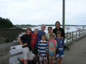
We met another family with two boys of similar age to ours, the Windsors. This was quite a treat — some adult conversation time for us, and our kids seemed to relish some real kid play time. On our last day in Northeast Harbor, we took the Windsors out for a day sail to Little Cranberry Island, just across the harbor.
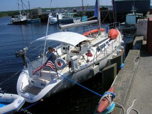
On Monday, the morning greeted us with ample sunshine and a steady breeze. Within a couple of hours, most of the visiting yachts vacated the harbor — apparently we weren’t the only ones looking for a good weather window! Karen and I had talked about the right timing and departure point to make the crossing to Nova Scotia, and it seemed like God had graciously handed us this day for that purpose! It is about 100nm across the Bay of Fundy to the typical arrival port of Yarmouth. I had done this same trip with my college buddies 20 years ago, but this time it was different… something to do with the responsibility of a family and my increased sense of the fragility of life! We figured we could set a conservative speed of about 5 knots, which would require a 20 hour passage. Based on this, we aimed for a mid-afternoon departure so that we would be assured of a daylight arrival. After discovering and taking advantage of a West Marine store in Southwest Harbor (thank you West Marine… our last opportunity for a decent marine store for awhile!), we dropped lines and headed East.
Although we had a nice 15 knot breeze on the way out of the harbor, the wind died enough and the ocean swells grew enough for us all to feel a bit queazy. Any time spent below only exacerbated the problem. There were two distinct wave patterns. One deep-ocean originating long swell, and another from a different angle generated by the local winds. This caused us to roll and pitch at an uncomfortable, inconsistent rate. Needless to say, dinner plans were reduced to simply mac-n-cheese! The good news was that we befriended another boat in Northeast Harbor that was making the same passage to Yarmouth, a father/son outing aboard Alacrity, and we established a two hour radio check-in and morale booster protocol. This was especially helpful when darkness fell and we were sailing along at a brisk 6+ knots into an eery blackness. The kids enjoyed the opportunity to stay up as long as they could. Our youngest hung in there until about 11pm, keeping me company with that kind of imaginative conversation that only occurs late at night. After an early evening nap, Zack hung out in the cockpit with me from midnight to about 4am.

One of the more alarming realities to mariners in these waters is the new high speed ‘CAT’ catamaran ferry. There are two of them, from Bar Harbor to Yarmouth and from Portland to Yarmouth. Did I mention high speed?? As soon as they have sea room, they throttle up to a cruising speed of 50 knots.
At that speed, they appear on the horizon, pass you and are gone over the horizon in about 15-20 minutes. I saw it coming at about 11pm back to Bar Harbor and followed it closely on the radar as it passed about 2nm away. The plume of spray off their hulls was shockingly high… I was glad to have this menacing creature out of view!
At 4am, with the sunrise not far away, a slight brightness was appearing on the horizon, a good source of encouragement after an inky black night. Karen came up and relieved me, and after a nap I awoke to a bright sunny morning and Karen pushing us along at 7 knots through a much more gentle swell! It was glorious! Just a slight increase in speed drove us through the swells more steadily and kept the sea-sickness demons at bay.
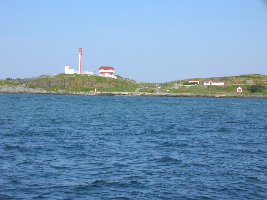
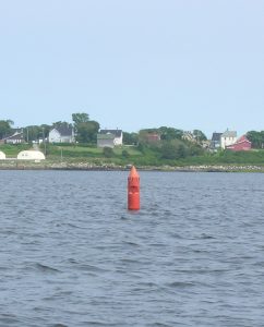 By about 8am, we began to see land… it was Canada! We sailed up the long harbor entrance to Yarmouth, past what our youngest liked to call the ‘crayon’ buoys, anchored and went ashore to clear through Customs. Our friends on Alacrity had just arrived earlier without issue.
After an hour and a few conflicting calls to customs, we were telephone cleared and off we headed to the nearest restaurant. We had skipped breakfast, it was well into lunch time, and we needed a place to celebrate our safe arrival!
Yarmouth was described in the cruising guide as a no-nonsense fishing town, but we took advantage of it’s streets and shops to stretch our legs and get a change of venue. Our cruising guide was a little too no-nonsense as well and we desperately needed more information about what to see and do in Nova Scotia. There must not be many people that go cruising in this area because we found no cruising guides in town, opting instead for a couple land-based tourist books.
Our most pressing challenge was to determine a plan for rounding Cape Sable, the prominent, most southerly point of land on Nova Scotia. At this Cape, one witnesses the confluence of the Bay of Fundy waters (with it’s 20+ tides) and the Atlantic coast waters. 20 years ago, when I sailed ‘Two if by Sea’ with my college buddies, we encountered so much current and tide rips at Cape Sable that we gave up rounding it and started heading home. Needless to say, I was a bit anxious about our plan of attack. 20 years had brought many changes, though. We had electronics now — GPS, chartplotter, radar, autopilot, etc. But more importantly, I had the frame of mind now to be more cautious and more respectful of Mother Nature. Finally, we had better books and references for tides and currents and suggested routes then before. We were going to nail this one!
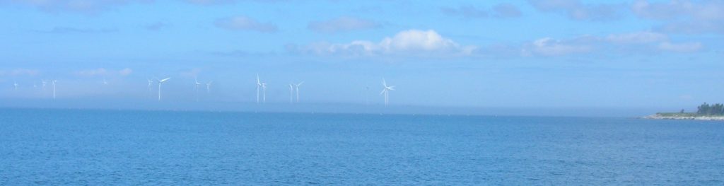
Our first step was to get closer to Cape Sable so that we could make the rounding in a reasonable day’s sail. Not long out of Yarmouth on Wednesday afternoon, we entered a heavy fog bank and carefully navigating our way to what looked on the chart to be a safe anchorage off of Jones Island. What a treat it was to awake in the morning and see land (including a nearby wind farm) that we could only image in the fog the day before.
After examining and re-examining the tide tables, current tables, corrections to get to the Cape Sable location, correcting for EST vs AST timezones, and many other opportunities to make a numerical error, we determined the best time to pass Cape Sable was at about 4:30pm Thursday during max ebb current. We were once again beset with heavy fog leaving Jones Island, leaving us to only navigate by GPS and radar. On the local charts there are numerous spots that are conspicuously labelled ‘tide rips’. Sure enough, as we transited these spots, the water would boil up from below, the natural ocean swell pattern would be broken by lots of scattered waves like the site of a disrupted anthill. The water was moving in so many directions it was hard to tell what was happening, however the strong ebb current was confirmed when we reached our first buoy waypoint about 3 miles off Cape Sable. The guide described a tricky inshore route, to avoid the brunt of the current, or a route 3 miles offshore. We were taking the more conservative offshore route.
If Cape Sable held any particularly scenic beauty, it would have to be enjoyed through a tourist guide, as we spent the entire day in thick fog. The winds were favorable so we had the benefit of sailing, but the autopilot was the best navigator. If Karen or I tried to steer, it was very difficult without a landmark to follow, just the compass. The monotony of a light gray shroud around you all day made it difficult to concentrate on one’s course. Thankfully, the autopilot performed it’s job admirably. The guide recommended a harbor on the east side of Cape Sable for those that just finished making the rounding, a place called Upper Port La Tour. Thankfully, the fog lifted for the final entrance into the anchorage.
When Friday morning came and we awoke after an interrupted night of blustery winds and concerns about the anchor holding, we were no less discouraged by the continued presence of fog. When they said this part of Nova Scotia has 90 days of fog per year, they weren’t kidding! We had the advantage of following our track on the chartplotter to safely get out of the harbor. Offshore, heading downeast, the winds were strong and favorable, blowing out of the south at 15-20 knots. The waves kept our attention too, as we watched rollers 7-8 feet pass under us. We were quite happy to be in a 47 footer, then our old 32 foot boat. Thalia handled the waves well and with the strong breeze, she maintained a good amount of momentum too.
Our destination was Shelburne, about 40 miles northeast and up a long harbor channel. When the fog lifted as we entered this channel, and the temperature raised by at least 20 degrees from the land breeze, we were shedding clothes faster then a runway model!
Shelburne has a lot of old nautical history — the home for top-quality shipbuilding in the 1800’s — and the destination for over 16,000 Loyalists fleeing Revolutionary War-era America. We are tied up to the government wharf here and look forward to less fog and more people — it’s been a lonely journey since leaving Yarmouth!