Up, Up and Away Ep. 69

We are docked in Waterford, NY today, at the confluence of the Hudson River and the Erie Canal. We’ll be doing a big left turn and starting up the Erie Canal tomorrow. There’s no training wheels on this excursion. The first day involves the transiting of 5 locks, each rising about 33ft for a total of 159 ft above the Hudson River. It’s indoctrination by fire! Check out this drone-based video of the area. Please make sure your seat belts are fastened and tray tables locked in the upright position!


A New York State Of Mind Ep. 68

I apologize to our friends in Rhode Island and Connecticut. We had every intention to visit your waters, but fate had other plans. I can hear you already. “But we are the Ocean State!” say you Rhode Islanders. And yes, the charming Connecticut shore is hard to miss as one works their way down the New England coast. But we got pulled into that powerful vortex that is New York – first, the city, and then the countryside. Continue reading “A New York State Of Mind Ep. 68”

To New York, ICW Style! Ep. 62

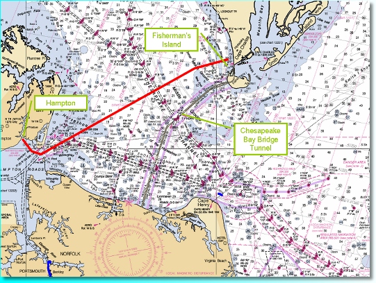
After nearly a week docked in Hampton, VA, and with the thrill of Busch Garden’s many rides still tingling our spines, we cast off the lines on Sunday. Our destination was a short hop away, across the mouth of the Chesapeake Bay to Fisherman’s Island. I felt a combination of excitement and trepidation – we were truly underway again, no comfort and safety of docklines and no protected ICW; we had to use our sailing wit once again to get us through. Perhaps, too, it was the small craft advisory being issued and the 170 mile haul we had offshore to get to the next reasonable anchorage at the mouth of the Delaware Bay. I could have easily accepted another night at the docks, but we had miles to cover and Mattapoisett, MA still seemed a long distance away. Still, it was pleasant to have some wind to work with, and we brushed off our sailing skills and made Thalia prove to us that she was more then just a little 50 hp powerboat. At Fisherman’s Island, we were within earshot of the Chesapeake Bay Bridge Tunnel, crossing between the tip of Maryland – Cape Charles – and the outskirts of Norfolk at Cape Henry. This 15 mile long bridge is an impressive engineering creation. Owing to the shallow depths of the Chesapeake Bay, they were able to build the bridge low to the water and then drop the roadway into a tunnel under the bay in two locations to accommodate the ship channels. This is the biggest of three such bridge/tunnels in the Norfolk area. I guess the engineers felt like they had a good thing going so that made a couple copies!

Continue reading “To New York, ICW Style! Ep. 62”

Men, Get Your Testosterone Here! Ep. 61

With our new crewmember, Grampa Wells, aboard, we cast off the lines from the public dock at Elizabeth City, saying goodbye to the gracious hospitality of the ‘Rose Buddies’ and their quaint, small town. With little wind, we motored about 35 miles back out into the Ablemarle Sound, then up the North River to rejoin the ICW at the beginning of the ‘Virginia Cut’. The ICW here splits into two routes to nearby Norfolk – the Virginia Cut and the Great Dismal Swamp. While the later sounds unappealing, it is considered to be the more scenic of the two routes. Opened in 1805, it was not just scenic but much safer compared to the ravages of the North Carolina coast for transporting cargo north and south. Flatboats were the name of the game back then, and they carried lumber and other critical supplies in and out of Norfolk, as that city became a major supplier to troops in the Revolutionary War. But, as the flatboats gave way to steamships, the Great Dismal Swamp met its demise due to its shallow depths. The deeper Virginia Cut came into being in 1859, and although traveled now by larger boats and commercial craft, it is no less stunning in its beauty. We dropped anchor at the small uninhabited Buck Island. According to the chart, we could expect depths of 7-8′, and thankful there is virtual no tide fluctuation here, as you can see that we had a measly 0.3′ under the keel!

But, whatever the depth, stopping here was a foregone conclusion. It was 21 years ago that my father and I anchored in the lee of Buck Island aboard my boat ‘Two if by Sea’. I remember the sky looking cold, gray and threatening, and perhaps that is way my Dad and I retreated to the cabin to rustle up some stew. Having limited culinary skills, we based this stew on what ingredients we had available, starting with a stick of kielbasa and several cans of beans. After whipping the drool off our chins (hey, mom was away and I wasn’t courting any girlfriends at the time!), we deemed our stew a success and dubbed it ‘Buck Island Stew’. To our amazement, Buck Island Stew has carried on through those 21 years and been served up on other boating and camping trips, most recently when my Dad and step mom visited us in Puerto Rico. On that occasion, we passed the ‘secret’ recipe on to the next generation – Zack – and although several changes have been made to the recipe that reflect a woman’s (read: Karen) touch, the stew is unmistaken bachelor in origin! And so, without question, and as we watched the sounder alternate between 0.3 and 0.4, Buck Island Stew was borne out of the Thalia galley to grace the dinner table once again! Here’s Zack on veggie detail, and Grampa and our youngest enjoying some first spoonfuls. That’s little Buck Island in the background.

Continue reading “Men, Get Your Testosterone Here! Ep. 61”

Being a Little Normal Ep. 60

This past week, the residents of Thalia participated in several activities and events which fell neatly into the “normal” range — something new for us! Although, with just over one month left of our adventure we are anticipating an abrupt return to lives filled with “normalcy”, day in and day out! I don’t think we are able to articulate — from our current perspectives — what this next major shift will mean to each of us. I, for one, have such a mixed set of feelings about our life back on land that I am truly perplexed with how I will respond. Time will have to tell this one.

Continue reading “Being a Little Normal Ep. 60”

Graduation – Better Late Than Never! Ep. 59

After three nights in Wrightsville Beach, NC, our New England roots were pestering us to put the pedal to the metal! At first light, Karen and I motored out the nearby Masonboro Inlet, one of the few inlets to the sea in this area that is easily navigated by sailboats. We decided to go ‘outside’ again to avoid several shallow areas in the ICW and to try to put some more miles behind us. Camp LeJeune, the infamous US Marine Corps base in North Carolina, was also right squarely along the path of the ICW, and the guidebook warned us that a military vessel blocks the ICW when they are firing across it. Yikes! No Thanks!

Our goal was Beaufort, NC, about 70 miles north. The morning started out glassy calm on the ocean and with the kids both still asleep below, Karen and I had a rare occasion to have adult time together. I suppose at this stage in the trip, we could all use a little more time with the same age group!

Continue reading “Graduation – Better Late Than Never! Ep. 59”

Life in ‘The Ditch’! Ep. 58

Poor Thalia, she hasn’t seen open water in over a week and a half! She’s been livin’ in the ditch and is not too happy about it, since her hull at the bow is growing the “ICW mustache” from the murky/muddy water she passes through. As Tom mentioned last week, “The Ditch” is the name boaters use for the section of the ICW (Intracoastal Waterways) from Norfolk, Virginia, to Miami, Florida. Even cruisers from Australia call it by this name, as we heard from our friends aboard “Our Island” who so thoughtfully gave us a guide to these waters which they wouldn’t be having a need of. This waterway even looks like a ditch in many areas as you navigate narrow cuts made through marsh lands and along canals sliced deeply into hard rocky terrain! Yet what a tremendous asset this waterway is for all boaters along the Atlantic coast of the US.  Continue reading “Life in ‘The Ditch’! Ep. 58”

Reader Beware… Another Helping of Southern Charm Coming Your Way! Ep. 57

Having bid adieu to Martin and Nancy last week, and casting off the lines at the comfortable Savannah municipal dock, we motored down the river in pursuit of the ICW. We found it at a junction named Fields Cut. This was one of many manmade cuts that we would navigate along the ICW over the next few days. The Army Corps of Engineers, the agency responsible for maintaining the ICW, made numerous cuts in the land when the track of the rivers, bent on spilling into the sea, refused to head in a parallel direction to the shore. The men and women of the Corps dredged these cuts and their connecting river systems to produce a roughly north/south route. At the time, they produced a waterway that had a minimum depth of 10 feet, measured at low tide, but as time passed, a number of places have shoaled in and caused the passage, by sailboaters in particular, to become an ongoing challenge of attentiveness. But, the ICW was the best option for us in this stage of our trip. We’d get a welcome break from the ups and downs of the winds and seas offshore, or ‘outside’ as everyone comes to call it. In the protection of the ICW, fondly labeled as the ‘ditch’, we could motor in flat water and give our sailing skills a rest. Additionally, there are towns and vistas along the way that are inaccessible from the ocean side, and, having a soft spot for the charm of small town America, our family would gets its fill of southern culture!

So, Karen guided us into Fields Cut for this new chapter in our journey, while we all kept a watchful eye on the depthsounder. With this first step, we crossed immediately into South Carolina – State #2 in our southern U.S. tour! Not wanting to push it too much on the first day, we chose a simple anchorage about 10 miles into the ICW, a little exit ramp called Bull Creek. We arrived at high tide, very high tide. The grassy marsh lands that go on for mile after mile into the distance in this part of South Carolina were barely peeking up above the water level. What on the chart looked like a 100′ wide creek was in fact a sea of water – only if you looked very closely could you see the occasional tuft of grass breaking the surface in sections. Nevertheless, we found the creek on the chartplotter and followed it about a 1/2 mile off of the ICW. After a quick circle to make sure we had enough depth to swing on the anchor, and following some debate among the crew on where the creek ended and the marsh began, we dropped anchor and easily set it amidst a steady outflowing current. Once we were sure the anchor was set, Zack and I jumped in the dinghy with the portable sounder to check the depths and we found the creek to be uncomfortably more narrow than we’d like. The sun was low in the sky and we needed to make this spot our home for the night, so, as a compromise, we set out the stern anchor to align us in the river and keep us from swinging into the shallows when the current reversed. This plan made sense from our past experience, but we had underestimated the power of the current in these parts. About an hour later, while sitting down at dinner in the cabin, we all could hear lots of water gurgling by the hull, more than we had come accustomed to in other current-rich areas. Examining the situation up on deck, we were surprised to find major whirlpools forming and spinning off of our starboard side, in the lee of the current. In fact the whole boat was listing to port in the current, as the keel tried to flow down river and the anchor lines up on deck were holding her back. It was so strong that our stern anchor line, made of stretchy 3/4″ nylon to absorb the shock of wind and waves at anchor, had allowed us to swing completely sideways to the current. Now, both the bow and stern anchor lines were being pulled as tight as steel rods, making us look like a gigantic slingshot being pulled back as far as it would go. It wouldn’t be long before something started breaking on the boat. I had the stern line led to a winch in the cockpit, and the load was so strong, I couldn’t crank the winch in to get us lined back up in the river current. After a quick debate, we decided to bend on another line to the end of the stern line to add about 75′ of length. This was sucked out the stern fairlead in record time and again the boat locked into a position perfectly sideways to the building ebb current. We couldn’t have picked a worse orientation for the boat – it would be much better to just swing on the one bow anchor. So, we tied a fender on the stern line and began to ease it off of the winch. There were four wraps around the winch. As I removed the first wrap, I could hear the line straining. Gingerly, I removed the second wrap, and suddenly, the line was pulled from my hand, flew around the winch twice more and was out the fairlead and below the water quicker than I could see it move. At one moment it was wrapped on the winch, the next it was gone in the water. I had never seen a line move so fast in my life! Thankfully, the fender was holding on to the end of the line; we’d deal with the recovery in the morning.

Continue reading “Reader Beware… Another Helping of Southern Charm Coming Your Way! Ep. 57”

Ladies and Gentlemen, Start Your Engines! Ep. 26

Well we finally left Hampton this week, after a few stops and starts and a few more trips to the hardware, marine and grocery stores. I think we have successfully discovered every nook and cranny on this boat and shoved those spaces full of provisions!

At the start of the week, we spent time with Ray Smith, our new crew member, to get him oriented to the boat and the rally. Ray’s a very amiable fellow, and plus, he owns a Jeanneau sailboat so he can’t be that bad! We all headed over to Bluewater Yachting Center on Sunday morning, Nov 5 with great anticipation for our departure the next day. However, the favorable weather window we had was closing rapidly and the rally organizers decided to postpone the start until Wednesday or Thursday. Although we were experiencing an exceptionally pleasant high over the area, there was an intense low moving towards us and would put us in rough conditions the first few days out. It was great to hear that the organizers made this decision, as one of my reservations about joining the rally was the likely pressure they would feel to send 75 boats, with crew members anxious and return flights already booked, off on schedule despite the predicted weather. The last thing I wanted to do was be out in rough conditions the first few days, especially in the Gulf Stream, which we would probably encounter about 24 hours into the voyage. So now we had even more time to prepare. If we weren’t ready for the trip with this extra time, shame on us! We spent one afternoon out on the Norfolk harbor practicing tacks, jibes, and reefing so that Ray could become comfortable doing these kinds of things, in the middle of the night if necessary. We also conducted a process called swinging the compass. This process measures the amount of error the ship’s compass has compared to a normal magnetic compass. With the many pieces of equipment, wiring and other objects that may throw off the compass onboard, it is good to have a deviation table of these errors, and the rally inspectors required it too. It is done by comparing the ship’s compass to a hand bearing compass every 15 degrees on the compass rose. When I’ve done this before, and when we did it now, it caused a bit of confusion to other boats in the area. I imagine they wonder why we can’t keep to a respectable course and why we continue in circles!

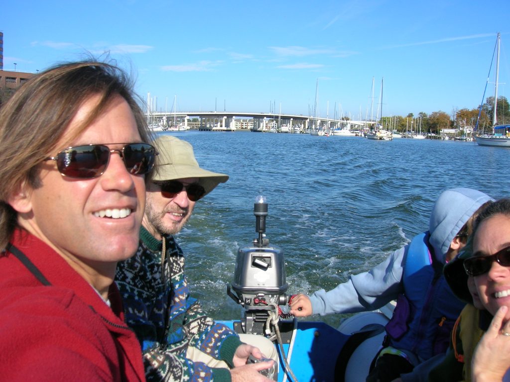
Each day during the week, we had a morning briefing with the rally and the latest weather was of course the main topic of discussion. At this point, we had become pretty used to the dinghy ride from our home at the Hampton municipal docks to Bluewater Yachting Center, the center of the rally and where most boats were docked. Here we are on a particularly bright clear morning. That’s Ray in the picture as well.
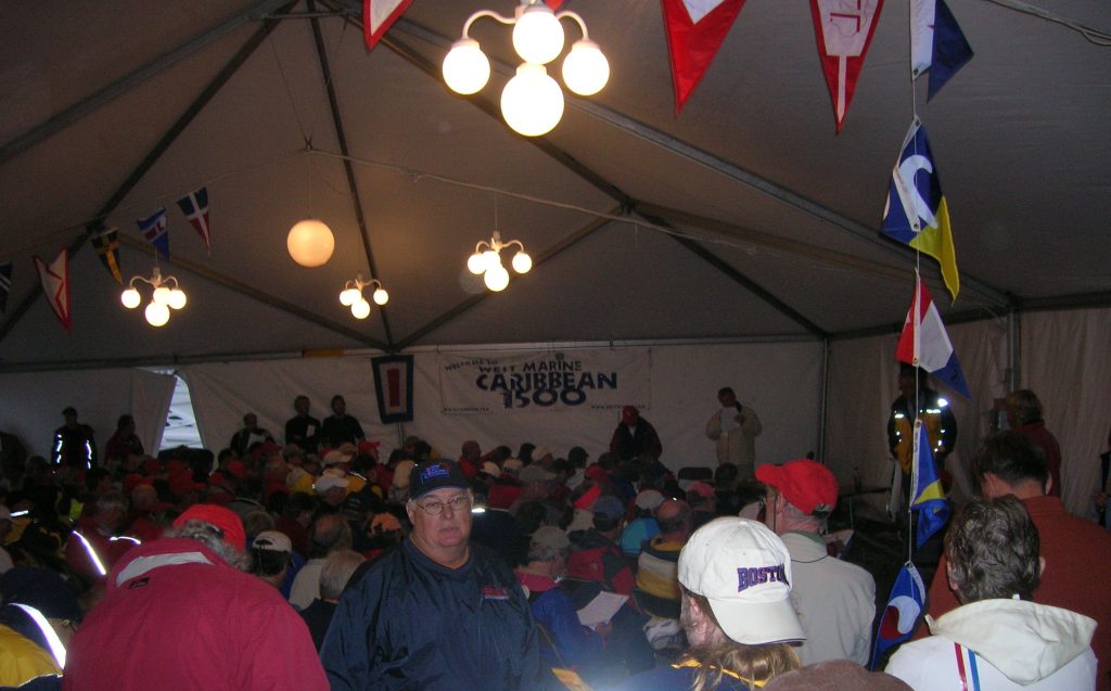
Here’s a shot of everyone in the rally tent, being briefed by the Carib1500 head, Steve Black. On the last few days before the start, no one skipped these briefings — we were all weather fiends at that point!
On Tuesday, it looked like we were going to be set for ‘launch’ the next day. The low would be passing over us in the evening with heavy rain at times. We decided to not dip into the ship’s stores so close to departure and instead opted for dinner ashore. We had been advised by the fleet doctor to not drink the night before. He said a sure guarantee for sea sickness would be fatty foods and alcohol, so we decided on a simple Italian restaurant and got loaded up on carbohydrates instead!

The evening passed as forecasted with steady rains and a morning that was bright and clear. One fellow boater on the dock that morning said I looked like I had a ‘bone in my teeth’! I’m sure I did, as we had been at the dock here for almost 2 weeks and we were all anxious to get moving! The start was set for high noon off of Thimble Shoal light. At 10am, we disconnected our shore power (bummer, no more heat!), cast off the lines, and headed out the harbor. Here we are, standing on shore in the States for the last time for many months!

As we approached Bluewater Yachting Center, we came to an immediate halt — this was the equivalent of the SF Bay Bridge at rush hour!

You can’t see it too well in this picture, but there is a continuous line of boats in front us out the channel to the harbor!

Once we finished the procession out the channel and entered the harbor of Hampton Roads, we were quickly enveloped in a layer of fog, not unlike the heavy fog of Maine. Where moments before we were surrounded by boats, now we could only see one or two at a time. Then, boats around us started to make erratic turns this way and that — what craziness was this about? Seconds later it became clear, as the superstructure of large containership loomed above the fog ahead of us! You could see the bridge, but not the hull, and to make matters worse, this ship was not blowing fog signals! The navigable part of the harbor in this area is very narrow, and knowing that half of the fleet was still behind us, this looked like imminent disaster unfolding. Ray grabbed the VHF and contacted the captain on Channel 13, letting him know that there was a fleet of 75 sailboats all around and in front of him. This captain blew Ray off by saying ‘Yeah, I can see them all’. Right! Even if he could find them all on radar, that doesn’t mean that our fellow sailors wouldn’t make a sudden last minute move unknowingly in his path. He passed through the fleet without incident though, and we all started milling around the start line. Here, you can faintly see the race committee boat in the fog.

Here’s some new friends of ours on Heaven Won’t Wait, a Beneteau 42. They are from Halifax so you know we had a lot to talk about! They also have their 10 yr old son Devan aboard. Coincidently, two of their crew, Linda and Mike Whitehouse know some of the folks we met in Rogue’s Roost, Sue Vey and Ben Doucette — indicative of the small world we are living in presently!

The start was more like a power boaters affair, as nearly everyone decided to motor across the start line. In this rally, you are allowed to motor if you wish and your total engine hours are logged and incorporated into the scoring. So there we went, motoring to our destination some 1500 miles away!

Please, Not Another Trip to West Marine! Ep. 25

This week’s update is a little unique – we haven’t moved anywhere! We have been at the town docks in Hampton, VA getting ready for the upcoming 1500 nm passage to Tortola, BVI’s. We have decided to join the Carib 1500 rally that leaves here, weather permitting, tomorrow morning (Monday). As some of you may have known, we had planned to have our friends from California, Martin and Nancy Thomas, join us for this offshore leg, but they had some medical concerns that arose at the last minute and had to cancel their trip. After some thought on our alternatives, we decided to join the rally here and also use their crew list to get 1 or 2 more people onboard. We were successfully in lining up Ray Smith, a sailor from the Washington DC area, who is here now and getting acclimated to the boat and the rally.

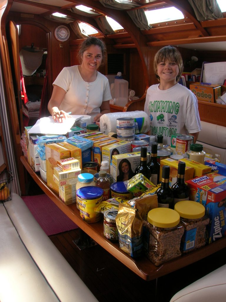
The folks that run this rally are very well organized. We have been spending quite a few days attending their seminars on a variety of topics including food/fuel planning, engine troubleshooting, medical issues and safety. We have been making numerous trips to the local West Marine and Lowe’s getting stocked up on additional safety equipment, spare parts, and anything we think we might need for offshore and while we are in the Caribbean. We rented a car earlier this week to run errands, including a super Walmart nearby, which was great for provisioning the boat, but comes with a challenge of where to put everything. Here we are trying to figure out that conundrum!

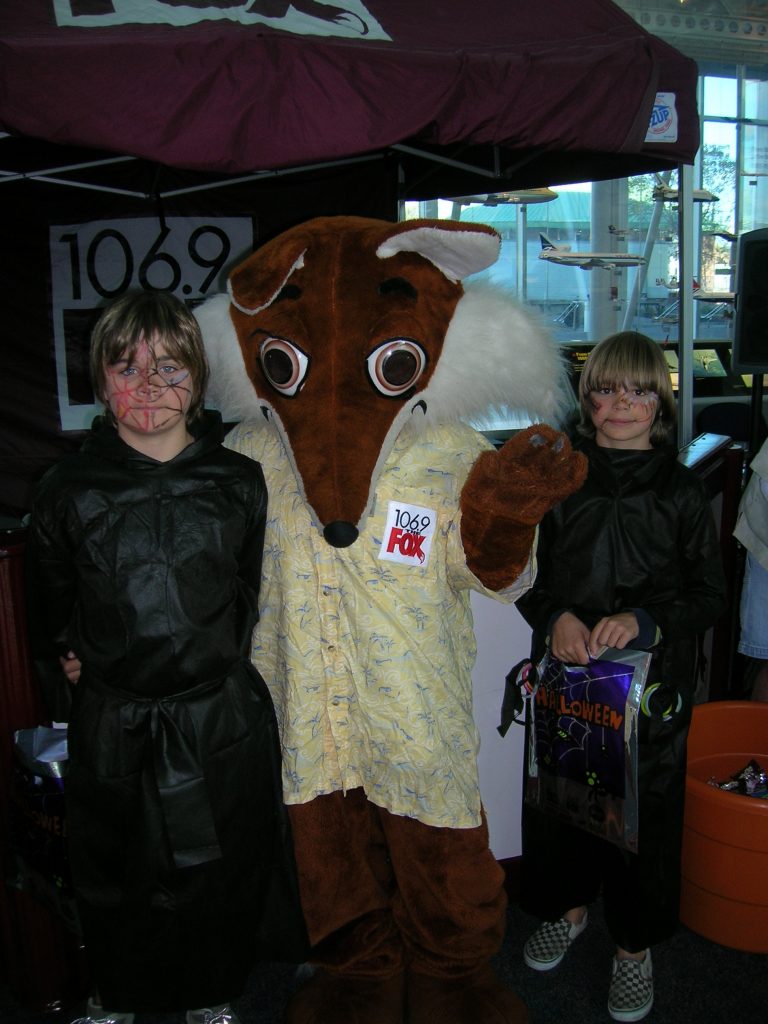
On one of our errands, we found simple Halloween outfits for the boys and attending an indoor celebration at the Virginia Air and Space Museum. This museum is very well organized and in some ways more enjoyable then the National Air and Space museum in DC.

Afterwards, they organized a short trick-or-treat walk around the area businesses in downtown Hampton, so the boys were able to still come home with a stash of candy!

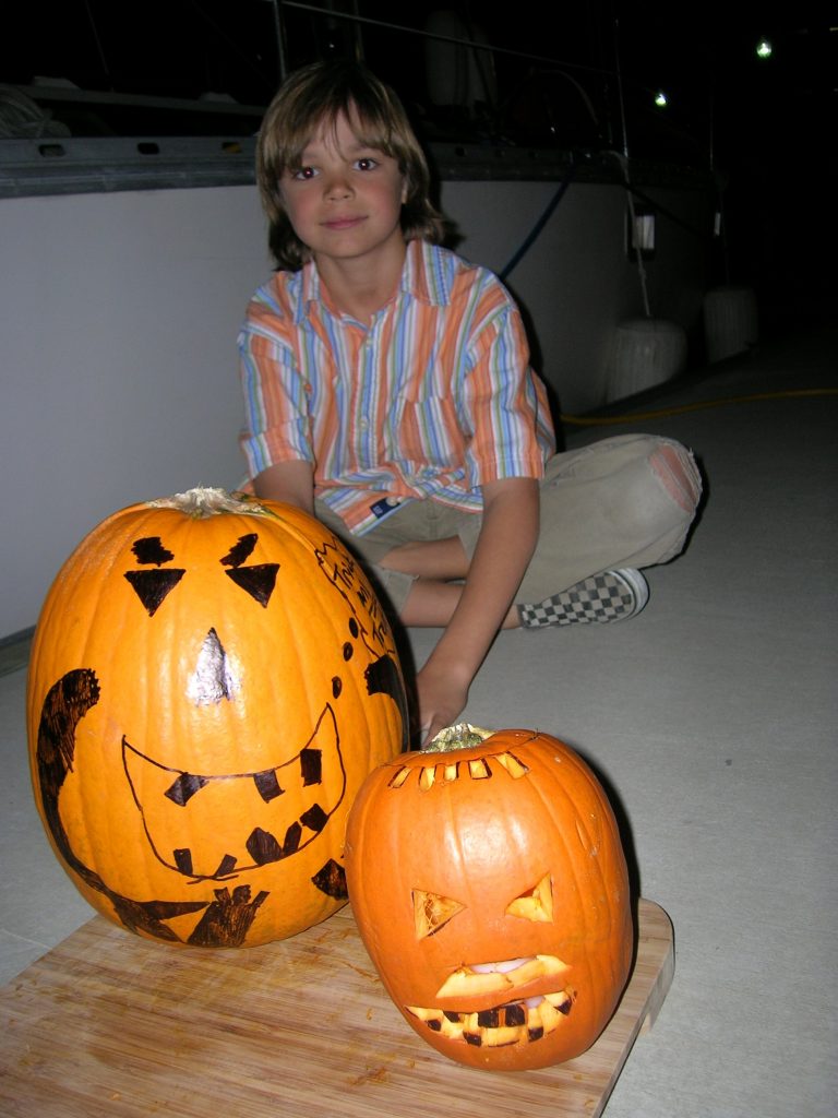
And, of course, a Halloween would not be complete without a few pumpkins!

So, getting back to the rally, the weather is looking favorable for the start tomorrow. We will be in the company of 75 other boats and checking in on the SSB radio twice a day with position reports and any pertinent news. Apparently, they will be posting the positions of each boat on their website, so if you are interested, check that site out. I will also be trying to sending position updates to the Pangolin link, so you can also look there if you want to follow along with us. Don’t panic though if you aren’t seeing updates coming through every day! This rally is well organized and they have been doing this since 1989, so if there’s any safety issues with any boats in the fleet, they will be on top of it and getting the help that is needed.

If the weather is favorable for the trip, we should be there in 9-12 days. We’ll be staying in Village Cay Marina, in Tortola for a few days and enjoying the celebratory dinners they have been planned. After that, our cruising plans are up in the air. We’ll be staying in that general area of the Caribbean for awhile, but since none of us have sailed in those waters before, we are leaving our plans open.

On a final note, I don’t know how easily we will be able to get to internet connections, especially in some destinations in the eastern Caribbean, so we may not be able to post weekly updates as timely as we have done in the past; we’ll do our best, though, to keep you informed on our progress.

Take care!