Having bid adieu to Martin and Nancy last week, and casting off the lines at the comfortable Savannah municipal dock, we motored down the river in pursuit of the ICW. We found it at a junction named Fields Cut. This was one of many manmade cuts that we would navigate along the ICW over the next few days. The Army Corps of Engineers, the agency responsible for maintaining the ICW, made numerous cuts in the land when the track of the rivers, bent on spilling into the sea, refused to head in a parallel direction to the shore. The men and women of the Corps dredged these cuts and their connecting river systems to produce a roughly north/south route. At the time, they produced a waterway that had a minimum depth of 10 feet, measured at low tide, but as time passed, a number of places have shoaled in and caused the passage, by sailboaters in particular, to become an ongoing challenge of attentiveness. But, the ICW was the best option for us in this stage of our trip. We’d get a welcome break from the ups and downs of the winds and seas offshore, or ‘outside’ as everyone comes to call it. In the protection of the ICW, fondly labeled as the ‘ditch’, we could motor in flat water and give our sailing skills a rest. Additionally, there are towns and vistas along the way that are inaccessible from the ocean side, and, having a soft spot for the charm of small town America, our family would gets its fill of southern culture!
So, Karen guided us into Fields Cut for this new chapter in our journey, while we all kept a watchful eye on the depthsounder. With this first step, we crossed immediately into South Carolina – State #2 in our southern U.S. tour! Not wanting to push it too much on the first day, we chose a simple anchorage about 10 miles into the ICW, a little exit ramp called Bull Creek. We arrived at high tide, very high tide. The grassy marsh lands that go on for mile after mile into the distance in this part of South Carolina were barely peeking up above the water level. What on the chart looked like a 100′ wide creek was in fact a sea of water – only if you looked very closely could you see the occasional tuft of grass breaking the surface in sections. Nevertheless, we found the creek on the chartplotter and followed it about a 1/2 mile off of the ICW. After a quick circle to make sure we had enough depth to swing on the anchor, and following some debate among the crew on where the creek ended and the marsh began, we dropped anchor and easily set it amidst a steady outflowing current. Once we were sure the anchor was set, Zack and I jumped in the dinghy with the portable sounder to check the depths and we found the creek to be uncomfortably more narrow than we’d like. The sun was low in the sky and we needed to make this spot our home for the night, so, as a compromise, we set out the stern anchor to align us in the river and keep us from swinging into the shallows when the current reversed. This plan made sense from our past experience, but we had underestimated the power of the current in these parts. About an hour later, while sitting down at dinner in the cabin, we all could hear lots of water gurgling by the hull, more than we had come accustomed to in other current-rich areas. Examining the situation up on deck, we were surprised to find major whirlpools forming and spinning off of our starboard side, in the lee of the current. In fact the whole boat was listing to port in the current, as the keel tried to flow down river and the anchor lines up on deck were holding her back. It was so strong that our stern anchor line, made of stretchy 3/4″ nylon to absorb the shock of wind and waves at anchor, had allowed us to swing completely sideways to the current. Now, both the bow and stern anchor lines were being pulled as tight as steel rods, making us look like a gigantic slingshot being pulled back as far as it would go. It wouldn’t be long before something started breaking on the boat. I had the stern line led to a winch in the cockpit, and the load was so strong, I couldn’t crank the winch in to get us lined back up in the river current. After a quick debate, we decided to bend on another line to the end of the stern line to add about 75′ of length. This was sucked out the stern fairlead in record time and again the boat locked into a position perfectly sideways to the building ebb current. We couldn’t have picked a worse orientation for the boat – it would be much better to just swing on the one bow anchor. So, we tied a fender on the stern line and began to ease it off of the winch. There were four wraps around the winch. As I removed the first wrap, I could hear the line straining. Gingerly, I removed the second wrap, and suddenly, the line was pulled from my hand, flew around the winch twice more and was out the fairlead and below the water quicker than I could see it move. At one moment it was wrapped on the winch, the next it was gone in the water. I had never seen a line move so fast in my life! Thankfully, the fender was holding on to the end of the line; we’d deal with the recovery in the morning.
You learn your lessons often in this sport and on everyday, there’s a new humbling experience. It didn’t take much to picture how either Karen or I could have lost a finger with a line under that much load. We’d find a better plan for multiple anchors in those situations, that was for sure!
With the help of the windlass, we raised both anchors from their deeply dug-in positions the next morning and started on our way. At this time of the year, South Carolina begins to get invaded by sudden and severe afternoon thunderstorms. These storms will appear from no where. You’ll be sailing along on a hot and humid day and all of a sudden a smack of cool moist air strikes your face, often from a new heading and sure enough, darkness will be upon you. This is what invited itself along our path, and we barely had time enough to head off the ICW to the nearest shallow shore and anchor.

We repeated a drill we had performed numerous times by now, where we would take all precious electronics and put them in the oven – the safest place for them if we were to be struck by lightning. A few hours later, and after a welcome nap for yours truly, we motored the rest of the way to a charming little town named Beaufort. Now, just to set it straight from the beginning, there are two Beauforts, one in South Carolina and the other in North Carolina. However, even though these states where fighting on the same side against those irksome Yankees, they couldn’t agree on how to pronounce the name Beaufort. South Carolinians say ‘Bee – YOU – feert’, while their neighbors to the north say ‘BOW – fort’. I’m aligned with the later group, but we all put on our best southern faces and practiced saying ‘Bee – YOU – feert’ a hundred times on the dinghy ride into the dock!
All kidding aside, any way you pronounce it, Beaufort is a beautiful town by the water. With at least one tall steeple, you could easily mistaken it for a traditional New England village. Stolling through town, we found free wireless at the local library and a tasty meal at a pharmacy-turn-restaurant overlooking the water. You might think it is strange that we spend all day on the water and when presented with some fine restaurant choices, we pick the one with a water view… go figure! I guess it is getting into our blood.
Like so many cities we encounter these days, many local governments have made wise investments to revitalize and spruce up their waterfront property. For us, it is the doorstep into their community, and when these towns add dinghy docks, clean streets, attractive lighting and nice boardwalks, we start spreading the word (as I’m doing here!) and hopefully it pays itself back to the town. One thing’s for sure, I can clearly remember the towns we visited, or tried to visit, with ram-shackle waterfronts, wondering all of the time if the front yard is so trashy, what must the rest of the house look like!
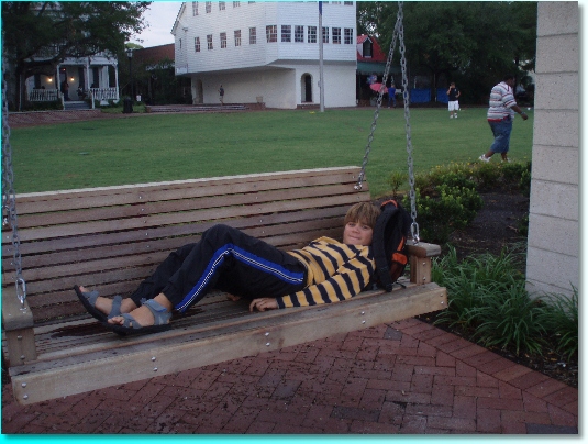
Here’s Zack chillin’ in one of about 50 new swinging benches for visitors to relax on and enjoy the waterfront views.
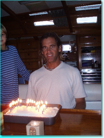
Conveniently, our stay in Beaufort coincided with my birthday, nothing special really, just me turning 29 young years… just don’t try reading the candles on the cake!
The next logical stopping point from Beaufort was the city of Charleston, about 70 miles up the coast. I had heard countless people tell me how wonderful Charleston is, with all of its history and nice homes, so we turned our bow towards the ICW once again. At 0500, we called the bridge tender at the Ladies Island Swing Bridge just north of Beaufort for an opening, one of only four scheduled per day. These early mornings are tough to roll out of the berth for, but once you are up, seeing the sky slowly brighten and having the whole day ahead of you, it’s all good. After an hour or two last night pouring over the charts, cruising guides and notes from fellow cruisers, I had identified three sections of the ICW that, due to shoaling, were going to be tricky for us to navigate. In two of them, we needed at least a rising mid-tide to have enough water to pass through, but we couldn’t have a rising tide for each one. Heck, there are only two per day, and one of those is going to be at nighttime! After some additional thought, we opted to go ‘outside’ and leave the shoaling ICW for smaller sailboats and the motor yacht crowd. We actually sailed! We were close-hauled, the winds were light, and the current was against us most of the way, but it felt good to feel the boat heel and to shut the engine down for awhile. By dinner time, we had made the entrance channel into Charleston, and, like Savannah, had to wedge our way in amongst the containerships and tankers. I felt like a little Cessna pushing our way into the flight path amongst the 747’s on approach to O’Hare! Here’s a video of a Mediterranean Shipping Company containership passing us in the channel.
After passing Fort Sumter, a very benign looking low-lying fort where the first shots of the Civil War were fired, we motored into our anchorage off the city and dropped the hook. There was still some daylight left and we noticed that a few boats away from us was ‘Dalliance’, sailed by our friends Marco and Holly whom we first met back in April in St Croix! We had left the Virgin Islands about the same time and had tried to keep in touch via the SSB radio, but from time to time weather or crew rendezvous’ left us hop scotching our way pass or around each other. They had been in Charleston for several days already and left us with a stack of brochures and suggestions on how to enjoy the city. Unfortunately, they had to be back to their home in Rhode Island by mid-July, so we wouldn’t be seeing them again along the way.
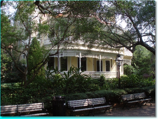
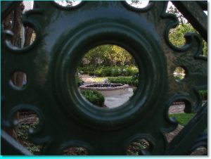
Charleston felt like a bigger city to me than Savannah, but it was still very walkable for us wheel-less sailors. If you were any student of architecture, you’d have plenty of examples to study in this city, but for us amateur admirers, nearly every street turned out a beauty of southern charm. We took so many pictures, it’s hard to narrow them down to something manageable, but here’s a selection from a bunch of wayward strollers.



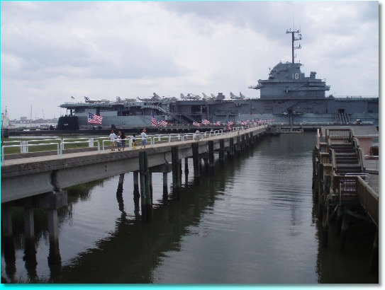
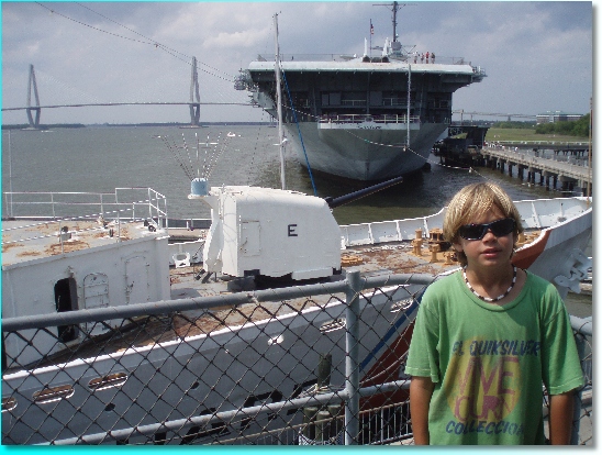
The strolling through town was getting us started on some much needed exercise and, on the second day, we chose to continue this theme by renting bikes for the day. Crossing the Ravenal Bridge – the longest cable hung bridge in the U.S. for you statisticians – we landed at Patriot’s Point, a site with a cornucopia of floating military history. Permanently docked here were the carrier USS Yorktown, plus a submarine, a destroyer and a Coast Guard cutter. You’d think it was Flag Day with so many stars and stripes flying, and we got a healthy dose of patriotism as we toured the ships. We lucked into a walking tour of the Yorktown by a guide named Jim Verdolini, a veteran of WWII and the Korean War and a sailor aboard the USS Randolph, a sistership to the Yorktown. He admitted that he was one of the last veterans in the area giving these tours, having just lost another colleague last week. It was a rare glimpse into a first hand account of day-to-day life aboard these ships during wartime and the narrow void between life and death. The kids grew a little fidgety from his many accounts of wartime action – indeed I saw the same blurry eyes I had as a kid when my grandfather continued on beyond my attention span about life up north as a goldminer – but hopefully some of it sunk into them. When veterans of these war periods are no longer with us, and we have to rely on second and third hand accounts, it won’t have nearly as much meaning. Here’s a collection of pictures from the site.

Being back in the US and on our last 2 months of our cruise, it seemed appropriate to be back on some kind of schedule. Gone were our halcyon days in the tropical waters of the Caribbean, but with a little planning, we could make sure we saw the important sites without feeling rushed. Besides, some discipline would be needed to get us ready for life back onshore! For now, I figured we need to make roughly 20 miles per day. If we made 40-60 miles on some days, then we could afford a layover day or two. With this in mind, we left Charleston and tried to earn some more layover days down the line.
We were surprised to see so little traffic on the ICW – mostly motor yachts and very few sailboats. When my Dad and I had transited the ‘ditch’ 20 years ago, you had to keep a watchful eye out foreward and aft for traffic. I know that the ICW gets very busy early in the Spring when owners and captains are moving boats up to northern states for the Summer. We were a little after this period, and it felt good to not have to be inundated with boats on tight timetables. Our day was mostly filled with school work and the engine droning on, pushing us at a constant 6 knots. So much of your life as a ‘power’ boat becomes more predictable, when you know your speed is steady and the water is calm, it is not much different then driving a slow car – you know where you are going and how long it will take to get there. This changed soon enough near McClellanville though, as the depthsounder started beeping at 4 feet below the keel, then proceeded to drop to 2 and then 1 and finally wouldn’t register any reading. We backed out about 100 feet and dropped the anchor, which had limited benefit because the ICW here was narrow enough that as the anchor line paid out, we slowly stopped drifting and rested with the anchor chain straight down close to the bank – our first grounding, albeit a mellow one. Thankfully, the bottom here is mostly soft mud. I jumped in the dinghy and sounded ahead of us, finding 8-9 foot depths in a 20 foot wide path straight down the center. I wasn’t sure if we would be able to find this narrow of a path, but it all worked out and we were on our way with a new sense of gratitude to see the depthsounder reading 4+ feet.
Earlier in the day, when we left the Charleston Harbor, we had been passed by an old tanker name ‘Thalia’, which was amusing but only the more funny when, after collecting ourselves from the ‘shallow water drill’, we were passed by another sailboat named ‘Thaelia’! This was too much. The closest we had seen to our name on this trip was a restaurant in New York City; now, in one day we ran across two other boats with the likeness of Thalia!

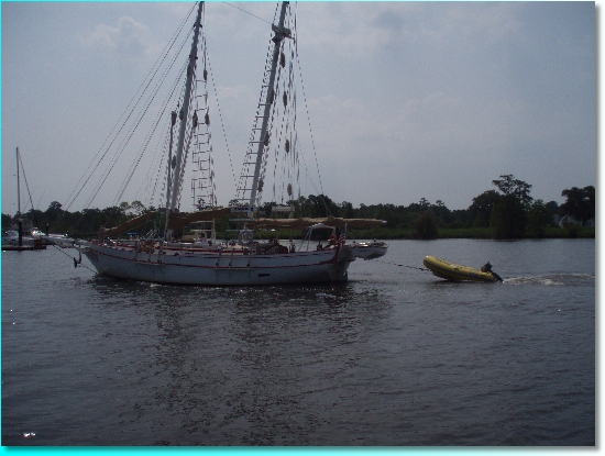
By dusk, we found a very quite, peaceful spot named Minim Creek just a stone’s throw off of the ICW. For a few minutes we sat in the cockpit and enjoyed the setting sun, but were quickly inundated with the unofficial bird of the ICW, the mosquito! It is fine during the day around here, but dawn and dusk are no time to sit outside and enjoy the great outdoors.
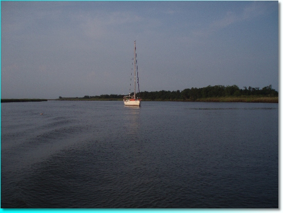
We were just one full day’s journey from the Myrtle Beach area of SC, and with a need to reprovision, we raised anchor early and started on another day of our motoring odyssey. What a wild day we had – wildlife that is! The previous day, we thought we had spotted a few alligators along the shallows near the banks and our suspicions were correct on this day as we left Minim Creek. We spotted several more alligators, one close enough to get in this video.
There would be no swimming today! Curiously, not 100 yards beyond these alligator sights were several porpoises playing in the water.
I’m not sure if there’s some symbiotic relationship between them, but this was one of many sightings of porpoises along the ICW. We had seen plenty in the Virgin Islands and on our offshore passages, but certainly did not expect to see them here in the brackish waters of the ICW.
Our course to the Myrtle Beach area took us up the long, winding and gradually narrower headwaters of the Waccanaw River. Thankful, this was a naturally deep river, which gave us more time to observe our surroundings. The land on both sides changed from the expansive marshy grasses to deep wooded trees. Cut into these woods occasionally were micro creeks, not more than a boat’s width which salamandered into the darkness, and would have made a fine movie set for the Pirate’s of the Caribbean. In typical U.S. fashion, even in this remote setting, there were plenty of buoys and daymarkers guiding us along our way. On one daymarker, we found several osprey nesting.
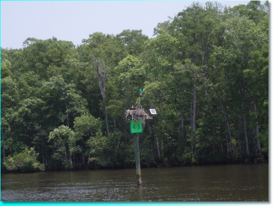
Many cruisers had told us that the ICW in Georgia and South Carolina was among the most picturesque they had seen, and having entered the Waccanaw River, we were starting to agree. The final stretch into Myrtle Beach entailed the negotiation of a swing bridge and a 10 mile stretch of manmade canal. I should have known things were going to change dramatically as a husband and wife team came racing past us on their jet skis at Mach 2. They really should be wearing crash helmets on those things! The houses rapidly became more and more closely spaced, and grander and grander along the shore, and in the blink of an eye, we were like commuters on the state highway watching billboards pass by! It was the strangest of contrasts, from a morning of alligators, porpoises and osprey!
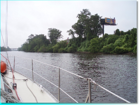
We settled onto a dock at the Barefoot Landing Marina, and quite a ‘landing’ it was, as we calculated that we’d have exactly 0 feet under our keel at low tide! This marina was part of a large development in the area. We were 50 feet from a 100 store outlet mall and three golf courses, all part of the same development. Strolling through the outlet mall, on a Tuesday night, trying our best to avoid crowds of teenagers, parents pushing strollers and 1 hour waits at the local TBonz restaurant, we were amazed at how everything in this country is on a ‘super-size’ scale. I do like my country, but, coming home after a long absence, this land of opportunity has turned into a land of excesses. It is all of our own creation, but is it really what we want or need? Certainly, our family has learned many other examples in the past year of how to run a society, and there’s a lot to learn from our neighborhoods beyond our shores. In the presence of these 100 stores, I found myself being drawn into them and their amazing variety and selection. I was sure I needed something that they had, but after walking the aisles, I came up empty handed. It was as if I had been pulled in by an imaginary sense of need. For the first few months of the trip, we’d crave a landing such as this, with everything imaginable available and open until 11pm. I’d walk in with a mile long list of stuff I needed. Then came the islands and a need to be more accepting of what little there was available. I’m hoping we can retain this lesson, that of needing less and the liberation it provides, after we land back at home.
Thanks for hanging in there on this ‘media-heavy’ trip update – the sights and sounds have been numerous this past week!
