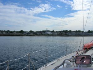
We left our friends, the Skillins, in Kennebunk this week and started making our way further south. There was a general willingness amongst the crew to continue our march south at a rapid pace in hopes of warmer weather. On Tuesday, we motored for 45 miles to Rockport, on the tip of Cape Ann, near Gloucester. Rockport is a quaint small town with an enjoyable waterfront area called Bear Skin Neck. Back in the War of 1812, this spot was the site of Seafencibles, a reference to men that were posted in forts to protect the harbor. They were overrun by the British in a surprise attack and taken prisoner. Fortunately, we faired better, as we sampled the goods from the local ice cream shop! It seemed like this spot would be teeming with visitors in the height of summer; now that school has started, we get to enjoy these areas with a bit more elbow room on the streets. Here’s a picture of the waterfront area as we approached to anchor.
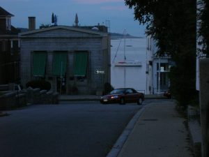
I got a lot of criticize from the family for taking many pictures of Thalia from the shoreline… why is it that some sailors, once off the ship and wandering ashore, focus instead on the ship from whence they come?!
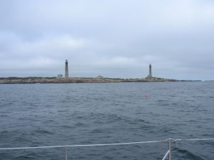
We left Rockport early on Wednesday for another day of motoring south in light winds. This was another trek of 45 miles to Plymouth, MA. Along the way, we passed Thatcher Island. Apparently, there was a two-for-one special running when they commissioned these lighthouses!
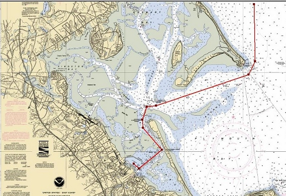
Fortunately, we didn’t have to wait long before stripping off layers of clothing and enjoying the warm sun on the foredeck as the autopilot guided us across Cape Cod Bay. It might be time for sunscreen again! By late afternoon, we entered the long, labyrinth of an entrance to Plymouth harbor. I understand the pilgrims decided to anchor offshore and row their shallop (a small wooden boat) to shore — a wise decision! Never before have we guided Thalia so close to sand flats and been so glued to the depthfinder! Here’s what the chart looks like.
When we entered Plymouth harbor, it was readily apparent we were not in Maine anymore! Shorelines packed with great stands of pine trees have given way to sandy beaches and low-lying islands. The water has changed color from a dark blue to lighter hues of green. You see the occasional Dunkin Donuts coffee cup or plastic water bottle floating in the water – a sign of the growing density of people in this area. Even the style of boats is changing. No longer are we graced with a morning wakeup call of Downeast-style lobster boats making their trek out to their traps. There still are lobstermen around, but on a wider variety of sometimes less seaworthy looking craft. There are far more sportfishing boats heading out to nearby fishing grounds or heading back in — all traveling at great speed and seeming to outdo each other in a race out and back. These boats vary from the large, offshore sportfishing boats with the immense flared bow cutting a substantial wake through the water to the more modest but no slower center console boats with one or more massive outboards. All of these boats are traveling at great speed. The comparative slowness of Maine is giving way to the growing “rush-rush” of a more urban area. I suppose this is all preparation for when we arrive in the New York City harbor!
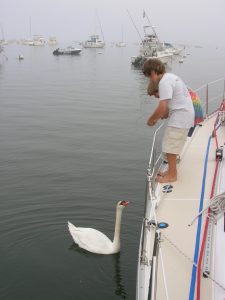
For the time being, there are still moments of quite splendor. While enjoying a dinner in the cockpit in Plymouth, a swan appeared and gave reason for the boys to use up some near-moldy bread!
On a grander scale, we are seeing much more sea life then ever before on the trip. From Kennebunk to Rockport and again from Rockport to Plymouth, we saw schools of porpoises and several times we enjoyed sitings of whales! I know this will be very hard to see, but here’s a video of a couple whales a short distance away. We were in the middle of school lessons, but we have a standing rule on the boat that school can always be interrupted by the siting of sea life, in this a couple whales.
It’s Saturday morning and we leave today for the Cape Cod Canal and an opportunity to explore Martha’s Vineyard and/or Nantucket. We are keeping a close eye on tropical storm Florence, destined for Bermuda and points north. It should start to have an effect on our area Sunday night and Monday. Unlike Castine, we will not be caught off guard this time! We have found several good ‘hurricane holes’ in the area, but we hope to not have to use them!
One last note… I have added nautical charts and the routes that we have followed thus far on the trip for those more picture-oriented visitors to the website! We’ll try to keep these up-to-date. You’ll find these scattered throughout the posting.
