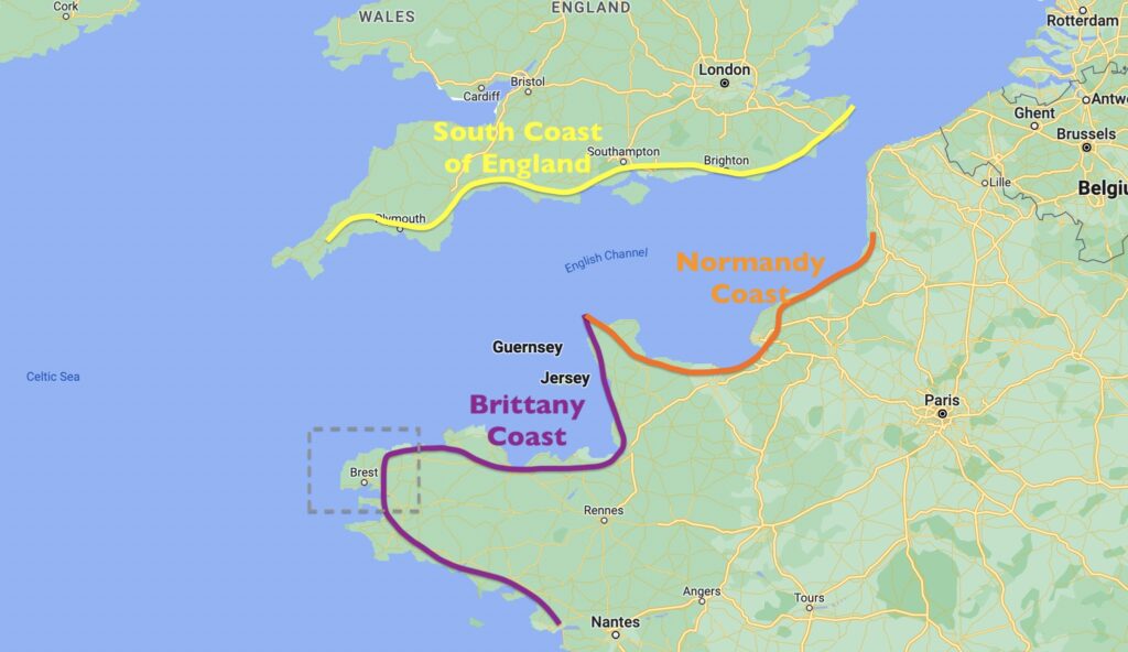
We were both a bit nervous about this next stretch of the Brittany coastline. The tides were big, there seemed to be very few places we could get into easily with our boat depth at low tide, and the cruising guide repeated cautionary statements about making passage along the coast with a favorable current and wind. We had a hard date in Weymouth, England to meet up with friends in two weeks, and we had set aside a few days in the schedule to wait out bad weather, but regardless, this coastline did not induce feelings of calm and tranquility. Our original plan at the beginning of the season was to sail along the entire French Atlantic coast, as we made our way up to Scandinavia, and visit the south coast of England on our return trip the following year. But that quickly changed as we learned how inhospitable to boaters the French coast can be beyond the Channel Islands and Cherbourg. The men on D-Day had a challenge landing on the beaches of Normandy for a reason. The tides are huge and sand shoals extend far out off the coast. There are very few suitable harbors for pleasure boats and it seemed like most boaters like us would push through a few overnights to get up to Belgium. Hopping across to the south coast of England and its more amenable shores seemed much less stressful.
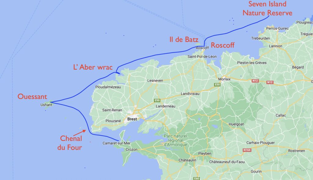
As we pushed away from the marina at Camaret-sur-Mer, our first challenge was to hit the Chanel du Four at slack. And no, that’s not a reference to a new perfume, but the narrow channel between the tip of land at St Matthieu, west of Brest, and a row of rocky islets and sand spits that lead out to the more prominent island of Ouessant. Hitting a very tidal area at slack is every boater’s goal, but sometimes the period of slack is so short – 15 minutes or less sometimes – and the distance to navigate so great, that you end up dealing with strong current either way. Of course, having the current against you is unpleasant, for no other reason that it takes you much longer to make way over ground. But having current with you in these narrow areas can be less than ideal too. If the wind is against you, short steep waves will pop up quickly. And you may be pushed into hazardous areas faster than you realize and on a boat that is less maneuverable due to chaotic seas.
To make sure we could fully concentrate on the conditions, we made a route on the chart plotter starting at the entrance to Chenal du Four and ending at Ouessant. A route is simply a string of waypoints that you create on the screen. We had used this feature lightly before, mainly for longer overnight passages in the Med to follow predicted wind shifts. But this day time passage required a lot of abrupt course changes to avoid shallows and to find key navigation buoys. I could tell right away that we would be using this handy feature in the future as we headed north into the island-strewn Baltic Sea.
When we entered the Chenal du Four at what was supposed to be slack, we encountered rough water and a 3 knot counter current. So much for a calm passage. We unfurled the jib only, to reduce our speed and stay in control. After we got through the narrowest part north of St Matthieu and turned northwest, the deep water widened and suddenly all of the current-against-wind white water was gone like someone had flipped the off switch. We were beam reaching in a strong breeze doing 7-8 knots through the water. In those conditions, it’s comforting to see the stress level fly away like aging pedals on a rose bud, left on the water for someone else to conjugate over.
There was a heavy haze on the water which made it hard to identify several tall, proud lighthouses warning mariners of these low lying sandy islets. Soon, the much taller island of Ouessant came into view. With strong winds out of the southwest, and even stronger winds arriving tomorrow, we had to take a pass on the normally advantageous harbor on the western end, close to the main town, opting for the rough-and-ready working harbor of Port Liboudou on the east side. Here was where all the work got done on the island – the engine room, if you will. At a concrete pier shockingly tall and full of holes on its seaward side like a block of extra swissy swiss cheese, the ferry from the mainland arrived twice a day. Right before it docked, several island buses would arrive to drop off passengers for the ferry and to wait to pickup the new arrivals. To service these passengers-in-waiting, two eateries were cut into the rocky hillside, with cafe umbrellas rattling in the wind gusts, encouraging their patrons to hold on to their napkins lest they become flying flotsam like other detritus taken skyward from the long row of garbage dumpsters across the street. In France, it is hard even in the most industrial of settings to have a really bad meal, but it felt a lot like an Interstate 5 truck stop along California’s Central Valley, wind-whipped and utilitarian in the way a vending machine is to roadtrip hunger pains. Toward the cliff-top plateau above our anchorage, on final approach to the island’s airport, flew a turboprop plane just above our mast. I guess this is a good option for those who couldn’t wait long enough for the ferry, or whose watery charm and slow-steaming attraction of the ferry had worn off long ago when they bought their summer cottage.

But like the French cafe, this anchorage, despite the heavy industry, could not be subjugated away from its roots in the natural beauty of a temperate island. Dark cliffs surrounded Sea Rose, protecting us from the strong winds above, where seagulls wheeled through the air looking for lunch, while a senior group of humans looking far more svelte than most younger groups was day hiking a ridge line through bright yellow spring flowers dangling delicately over the cliff edge. A harbor like this on the mainland would be interesting, but caught up in the demands that only access to the mainland can dictate. This was all about the geography of an island, land that couldn’t be reached by simply taking an exit off the throughway. You had to consciously plan your travel here, by ferry, prop plane, or small sailboat through the heady perfume of sea foam, courtesy of Chenal du Four. When there’s work, the prize is all the more sweet.
We dinghied ashore to a 100m long boat ramp, so designed to accommodate the 7m tide range, forcing us to wheel our dinghy up to a perch above the highest seaweed line to make sure she didn’t float off at high tide. There, our rough-and-ready port had a corral of bikes for rent, and we splurged hedonistically on a pair of electric models for our 2 day stay. It took us a while before we were ready to try speed setting 5, the one with the most juice, but once we did, the laughing could not stop! It brought back memories of my dad running beside me on my trike, his hand on my back, pushing me faster and faster.


The French invested heavily in lighthouses along this coast, and Ouessant’s own Phare du Créac’h did double-duty as a museum of lighthouse history and technology. We’ve been to a lot of lighthouses over the years and seen our fair share of Fresnel lens and the advancement of lighthouse design. But this museum was by far the most extensive, with so many Fresnel lens’ on display, focussing their light laterally across the museum rooms, that I ended up with that type of temporary blindness one gets after staring at the sun too long. Alas, all of the descriptive information was in French so precise vision was of limited use.
As we zipped by in our electric bikes, casually pedaling past old school bikers, we arrived at the western end of the island where a harbor full of empty mooring balls lay before us, save for two sailboats who had missed the weather forecast and now were rolling from gunwale to gunwale, likely already contributing their breakfast to the sea, and cursing their partners for having the crazy idea of sailing the Brittany coast. Ahh, the sweet freedom to critique from the safety of the shore!
We took our bikes off piste in search of a dull, distant humming noise up ahead. The hum soon turned into a roar. And if a roar is what a lion does, this was one angry pride ahead. Sea spray rose vertically from the water in what I can only describe as a cacophony of ocean rollers, some breaking into a sheer madness of white water at least a kilometer out to sea. Others smashed their water molecules to smithereens on the beach and then dragging them back to the depths over bowling ball sized rocks, which in turn tumbled over each other in their own barrage of sounds like a thousand reverberating oil drums. Several photographers were tripoding their cameras, wiping their lenses free of salt spray between shots, confounding a sense of reason while someone would subject expensive gear to the ravages of the sea.

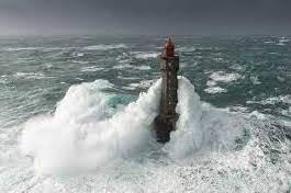
Yet, these waters have a pedigree for photography. In 1989, French photographer Jean Guichard, famous for his images of lighthouses, hired a helicopter to shoot pictures of the La Jument lighthouse, the lighthouse you can see in the distance in the picture above. Except, on the chosen day, quite a tempest was brewing and Guichard captured not only the seas enveloping the lighthouse tower, but, amazingly, the keeper coming out the door to look at what the helicopter noise was all about. When I was a young San Franciscan, looking for a poster for my new apartment that would sum up my passion of the ocean, I stared long and hard at this image, before finally settling on a much more tame poster of Cape Cod. I would never have guessed at that ripe young age I would some day look out over the water with my own eyes at that exact same lighthouse. One’s destiny can never be assured, nor can it cease to amaze.

Some people wonder if all we do all day is sail across a placid sea and end the day with a cold beverage overlooking the sunset. There are days like this, just as there are great days at the office or weekends of home improvement. But often forgotten are the long hours of research and planning. Very rarely do we visit a place twice, although the ease of doing so is a tug-of-war of temptation. As first-timers everywhere we go, upfront research is critical. We have an extensive library onboard, only outdone by a bigger collection of older pilot books back home. For the complex regions such as in Brittany, we are also pulling data from many sites on tides, currents, marina openings and depth, wind, rain and thunderstorms.
When we exhausted ourselves and our electric bike batteries, we settled down to an analysis of sailing data for our next leg from Ouessant to L’Aber wrach back on the mainland. I felt like my head was going to short-circuit as we tried to find a happy medium between a favorable northbound current and slack water at the entrance to L’ Aber wrach. This was a zero-sum game and if someone won, another would have to lose. In the end, we took the cost of a counter current for the ease of a slack water arrival. Although trusting the time for slack was not easy given our experience coming through the Chenal du Four.
To make this compromise work, we’d have to leave at 11am the next morning. Never before have I found it so difficult to sit on the boat, on a sunny day and a moderate breeze, and wait! I felt like the wait of an expectant child as his friend slowly blows out the candles before everyone can have birthday cake.

Finally, we were off. In the wait, the wind had died, leaving us to motor over a glassy but rolly sea, swells being the parting gift of an exiting storm. The entrance to L’ Aber wrach was fraught with the hazards of rocks and oyster beds but our timing of slack was spot on, as we approached a nearly empty mooring field. Just as we secured our lines, three other boats arrived simultaneously. We were not the only ones seeking the comfort of a slack tide-arrival. A full day on the boat pairs well with a brisk walk ashore, like a savory crepe and a chilled glass of wine. Here too we discovered the foundations of French youth sailing. A school had filled an abandoned waterfront hotel to the point of bursting and construction was underway for an entirely new and modern suite of sailing school buildings. Ahh, to be young again!
We were off our mooring at 630 am the next morning as the light was just coming up. Although we didn’t have a long way to go to the next port of Roscoff, 33 miles to the north, we needed to navigate through a rock strewn narrow passage called Ile de Batz at high tide in order to have a comfortable amount of water under our keel. It was another windless day, leading us to motor once again. As we arrived at the entrance to the Ile de Batz, a line of boats came toward us, as we all aimed to get through at slack. Watching the depth instrument closely, we registered a few 8m readings, areas that would be high and dry at low tide in 6 hours. It was a good decision to come through at high.


Roscoff is a popular port of call for big overnight passenger ferries from the UK and Ireland. From a distance their bright white hulls and high decks with evenly spaced portholes are easily mistaken for a cruise ship until their stern appears and the large folding ramps are visible. If you wanted to have your car with you on a summer holiday in France or Spain, it looked like a nice way to travel.
Quite often, these ferry ports are nothing more than a transshipment point – dusty, dirty, and gritty affairs. But Roscoff was full of attractive old stone buildings, with a fun college vibe as well, on an account of the marine biology research center, Station Biologique De Roscoff. We had also found ourselves arriving at the beginning of the Onion Jack Festival, a celebration of the town’s roots in onion farming. As you might guess, the food offering was a variation of French Onion soup which we both slurped down eagerly, while all the locals opted for the reasonably priced draft beers. There are some universal truths in the world.
The onion harvest in Roscoff led to a brisk trading business with their counterparts across the English Channel in Cornwall. Roscoff farmers would sail their crop of unique pink ‘Onion Johnnies’ across to England and pedal them, literally, door to door on bicycles. By the looks of it, the English had returned the favor by pedaling their love of beer with the Bretons.

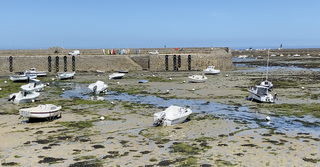
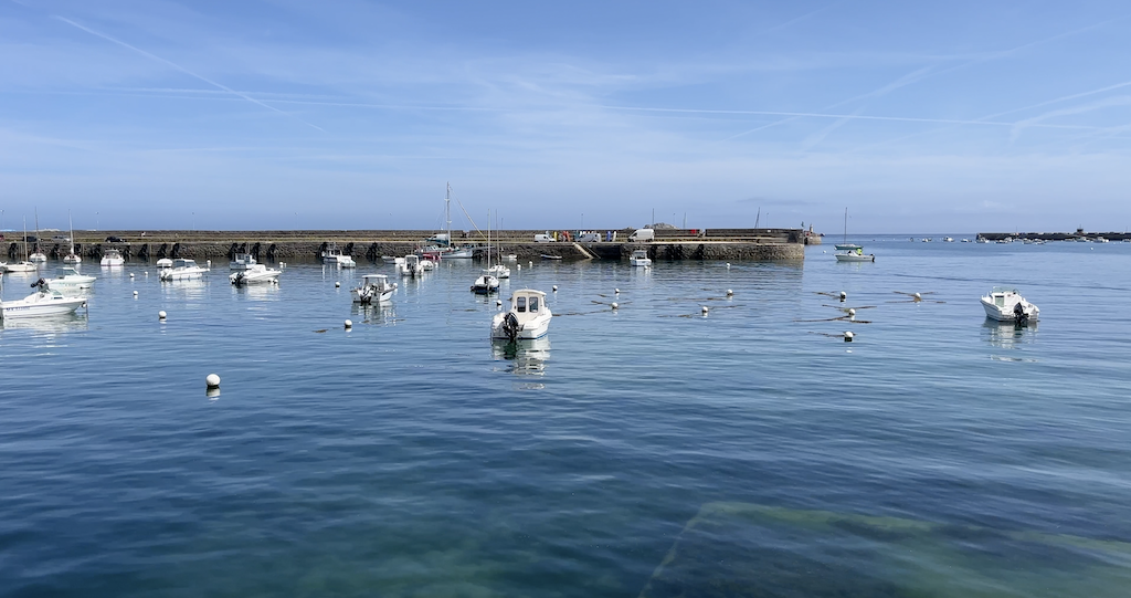
The original old harbor of Roscoff, protected behind several large breakwaters, was a good example of a ‘drying out’ harbor. At low tide, all the boats and their mooring gear were high and dry. For sailboats with a single keel, they would secure a stout wooden post down both sides of the hull, to keep the boat upright. Some owners had walked over and, with use of a ladder just like at a boatyard, had setup to do work on their hull. At high tide, the harbor magically expanded out to it’s extreme boundaries, making for a spaciousness that a boat navigator would dearly cherish.
Across the Ile de Batz channel is the island of the same name, served by a popular foot passenger ferry. The weather gods looked down favorable on us the next day as we ferried to the island under bright blue skies to find a settlement as old as Roscoff, but absent of nearly all vehicles. Out of necessity for some, but an opportunity to commune with nature for others, couples, families and soloists followed a meandering dirt path around the perimeter of the island, showing a particular skip in their step or a zest in their pedal, perhaps feeling the connection between this warm day and the excitement for an impending arrival of summer. We were all like school kids, knowing the last bell of the school year was about to ring, freeing us to race off into the summer of our dreams.
On our boat ride back to Roscoff, I had to tip my hat to the captain, as he nosed the ferry alongside a sloping concrete ramp of steps descending down into the sea. This was the practical solution to offloading passengers at any state of the 8 meter tide cycle.

Roscoff, with all the ferry traffic, is an official customs arrival and departure check point, giving us the opportunity to clear out of the EU as we made plans to cross to England.
We fueled up and bid adieu officially to France in the morning, although we managed to sneak in one more night in French waters at the Réserve Naturelle Nationale des Sept-Îles, or Seven Islands Nature Reserve. As we circled and found the right spot to anchor, a sign reminded visitors to stay on their boats and not come ashore. The purpose was clear, as a collection of puffins, their big bellies relative to their little wings, struggled earnestly to take flight and find safety on the green cliffs ashore. The puffin is a species that is normally found in the extreme north, in particular in Iceland. This collection of Brittany islands is about as far south as they will come to nest in the spring. One last entry in the Big Book of Brittany Facts. Next stop, the Channel Islands!
Be sure to also checkout the video content on our LifeFourPointZero YouTube channel. We regularly post updates on our sailing adventures, as well as how to videos on boat repair, sailing techniques, and more!


I thoroughly enjoy your creative and descriptive writing style about your amazing travels. It almost feels like we are onboard the Sea Rose with you! Safe travels to you both!
Thanks very much for your kind words Tim!