There’s just something special about being back home – at least the familiarity of U.S. soil one enjoys by visiting the US Virgin Islands. After our stressful overnight of dodging unpredictable thunderstorms, we welcomed the calmness of the harbor and the American-esque scene ashore. I had built a long list of errands that would be easiest to do in a place so connected to U.S. products and services, and we spent several days in Christiansted checking items off the list. The US Postal Service serves the USVI’s with their normal domestic US rates, and we took advantage of this fact to send out many packages to points back home. In fact, we did so many errands in the first three days in Christiansted, I have a hard time recalling what we did for pleasure – such is the downfall of a well connected island! While I can write about the joy we had in finding ‘Cost U Less’ a Costco-type store here that is a boon for a family of four trying to re-provision a sailboat, I don’t think you’d understand our excitement! However, here’s a picture of the net result… our loot ready to load aboard Hermes (name for our dinghy!) and then onboard Thalia.

The town of Christiansted has a surprising number of jewelry and other tourist oriented boutique stores – something you’d consider common if there was a cruise ship dock in town – but there wasn’t. St Croix is the largest island of the USVI’s and did appear to get a steady influence of visitors from other sources; in the harbor, we witnessed the continual take-offs and landings of sea planes from San Juan. With their ties to the U.S., it seemed like a lot of mainlanders were coming down here to visit or live.
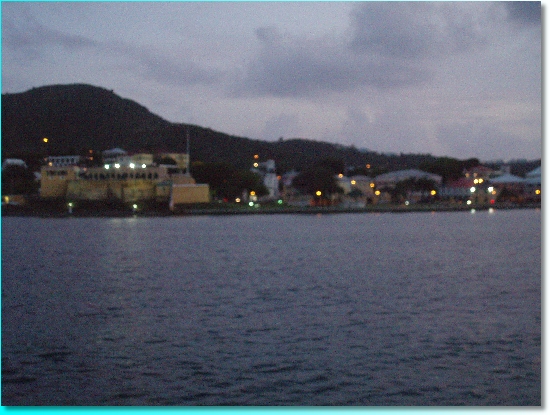
After completing errands, we got out and played tourists for an afternoon, walking the grounds of the Christiansted National Historic Site. As you know, I have a soft spot for the National Park Service. Having not seen those green and brown uniforms since we were in St John last November, it was yet another sign of familiarity as their smiling faces greeted us at the visitor center! The National Park Service maintains five key historical buildings here on the waterfront – including the old Customs House, the Danish West India and Guinea Company warehouse, where slaves were auctioned in the courtyard, the Scale House, where all products were weighed before export, and the imposing Fort Christiansvaern. If we had been able to shoot this evening picture on something steadier then our rolling deck, the waterfront, with the Fort in yellow on the left, might have come in clearer, but you can still get the idea I hope!
The Fort was built by the Danish, using bricks brought over in their ships, and it was one of many Danish landmarks around the island. The Danes divided the island up into 375 plantations of about 150 acres each. True to their heritage, they often employed windmills to assist with the processing of the sugar cane. Many of these stone windmill foundations dot the countryside and the villages. The Danish era on the island lasted from 1733 to 1917, but St Croix actually was under the control of 7 different countries at various times – including the usual Caribbean colonizing suspects like the British, French, and Spanish and the not so usual Knights of Malta.
We had a stirring conversation with one of the National Park Service guides about present day life on St Croix. Like many natives here, his ancestors had moved to St Croix from Vieques, a small island about 40 miles to the northwest, off the coast of Puerto Rico. Apparently, when the US government took over Vieques as a military outpost and bombing range, the mostly sugar cane economy gave way quickly to construction jobs for the U.S. military. But those jobs were not sustainable, and soon, with the island’s economy in shambles, many residents decided to leave and seek their fortune (and refuge, from bombing practice) on St Croix. Shunning an opportunity to criticize the US government, our NPS guide regaled us on the advantages that islanders have as part of the US territories. He was quite angry at those among his fellow islanders that chose to sit around and make excuses for their condition instead of taking advantage of their connection to the U.S. It was a welcome and refreshing view of our homeland; here was a man that still believed in America and it’s land of opportunity. Certainly, we had met many in the past year that viewed America with suspicion, mistrust, or loathing. It was nice to hear that some people still believe in what our founding fathers had worked so hard to establish.
With our boost in patriotism, we awaited the arrival of my father and my step mother – our real reason for stopping in St Croix. After dodging their own series of thunderstorms and tornados, they arrived a day late in Christiansted and climbed aboard for a week of Caribbean sailing. My Dad was a seasoned veteran onboard Thalia, having sailed with us last Fall in the Delaware and Chesapeake Bays. However, his wife June grew up on a ranch in Arizona and needed some time to get accustomed to the new surroundings. So we chose a short 5 mile hop to Buck Island off the coast of St Croix. Buck Island is managed by the National Park Service and is formally known as the Buck Island Reef National Monument. If you are like me, you might think by that description that some monolithic granite structure dominated the island, but instead, it was a protected marine reserve with only green vegetation and hiking trails on land, and clear waters off the beaches. We saw several sea turtles on the way in to anchor. It was the perfect start to a one week Caribbean cruise, if you ask me!
With the indoctrination underway, our next day would be a full one – a 50 mile sail to the island of Vieques. Vieques, along with its neighbor Culebra, are part of Puerto Rico but to cruisers they fall under the marquee of the Spanish Virgin Islands. Even before we had left New Hampshire, I had been told by land bound cruisers that we must visit the Spanish Virgins. In contrast to the crowds of boats in the British and US Virgin Islands, the Spanish Virgins were reputed to be a welcome isolationist retreat. Strangely enough, we had the US military to thank for much of this isolation. It all started back in 1898, the year of the Spanish-American War, when the US took over Vieques. Sugar was king at the time and there were four large centrales (sugar mills) in operation. In 1941, the US Navy arrived on the scene, buying up two-thirds of the island. While this brought temporary prosperity to the island in the form of construction jobs, as I mentioned previously, many of the inhabitants were forced to seek opportunity in St Croix and other local islands once the building was complete. The US Navy proceeded to use much of the island for training and aerial bombing exercises. Over the years, the actions of the US Navy were protested repeatedly by those who wanted to see the military actions halted. Finally, in 2003, the Navy ceased all bombing activity and just recently the land was turned over to the US Department of Fish and Wildlife. Locals and cruisers alike were anxiously waiting for the day when the occupied land would open up and pristine beaches could be re-discovered. We approached the island with much anticipation for discovering a new piece of paradise in the Caribbean. But, upon arrival, we discovered there were a lot of politics still at play, and most of the island was still off limits. Locals saw the handoff to the Fish and Wildlife as nothing more then a shuffling of papers. According to many islanders, the US Navy had only done a cursory job of cleaning up the land, including that item which everyone feared – unexploded ordnance! It was not clear whether or when the Fish and Wildlife would do a proper cleanup and when the land would open up. No one we talked to wanted the land to be developed; they just wanted it opened up to the public for beach access, hiking and the like. There were some nice inns and small, boutique resorts on the non-military land, and if you could look beyond the political struggles at play, Vieques offered a beautiful retreat from the hub-bub of this area of the Caribbean.
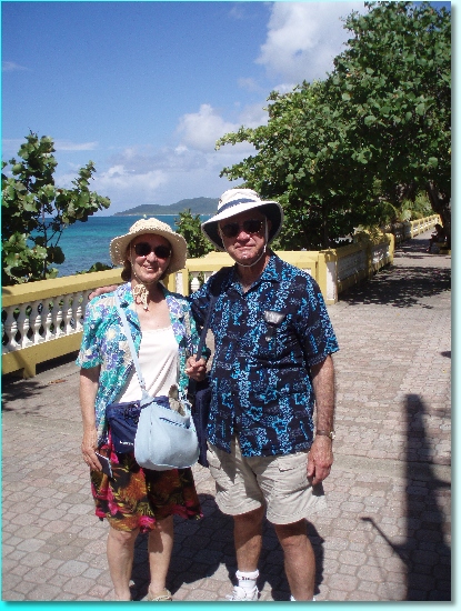
We anchored on the first night at the only town on the southern shore, Esperanza, which consisted of about 10 buildings set back from a nice strolling boardwalk. The first adjustment we had to make was the immersion into everything Spanish. Like its Puerto Rican parent, Vieques’ dominant language was Spanish, although you could find some folks that were bilingual, mostly those in the tourist trade. Here’s my Dad and stepmother along the boardwalk.
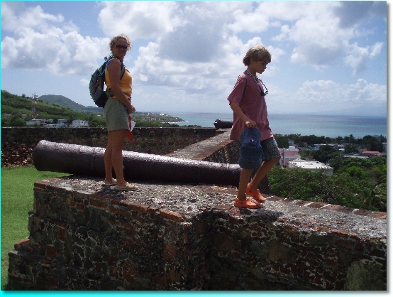
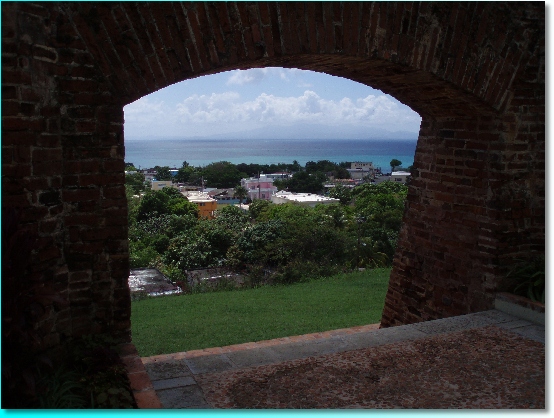
There are no formal buses or taxis on the island, but if you want to get around, you ride on what they call a ‘publico’. They are supposedly licensed and the drivers were very courteous and spoke enough English for us to get by. We took a ride to the other main town on the island, Isabel Segunda, on the northern shore. This was a bit more settled of a village, as the ferry from Puerto Rico landed here, but as it was a Sunday, we found very few businesses open. On a hill overlooking the town are the remains of a Spanish fort. We have seen a LOT of forts on this yearlong journey and some of you may be dreading another story of a fort, but this one is special – and it won’t be the last! This fort, Fort Conde de Mirasol, was the last fort built by the Spanish in the New World.
Inside its grounds was a thoughtfully constructed museum of local history and the ever-present topic of the Navy lands. Not only were the locals angry at the US government, but, through a series of cartoons on display, they vented their frustration with Puerto Rican government officials who seemed to be placating both sides of the argument. It was clearly evident that this had been a struggle since the Navy showed up in the 1940’s. Fisherman, seeing how the bombing restricted their activities, were some of the most vocally resistant. Reading a lengthy accounting of the civil disobediences over the years, it became painfully clear why, when I gave a local fisherman a big wave as they motored past our anchorage, their response was barely discernible!
My Dad and June spent the night ashore at an inn, while we anchored around the corner at one of Vieques’ attractions that had nothing to do with its political struggles. The spot was named Mosquito Cove, but travel brochures smartly referred to it by its main feature, the Bioluminescent Bay, or simply the Bio Bay. What an experience it was! This was unlike the bioluminescence we had seen back home in Maine where spots of plankton glowed in the water as you sailed or paddled along at night. Here, large balls of water glowed a bright bluish-white color. We paddled our kayaks in after dark and as we ventured further into the calmness of the cove, the bioluminescence became more and more spectacular. Great twin balls of blue would trail behind our kayaks, and the curling wake from the kayak’s bow would glow prominently. If you trailed a finger in the water, it was as if your digit was a bright fluorescent marker, tracing out letters or shapes of a whimsical nature. This surprise of nature was due to a combination of factors. The phosphorescent plankton, called dinoflagellates, are driven into the cove by the prevailing wind and waves, and since the narrow entrance is quite shallow, the plankton can’t easily swim back out, so there numbers continue to grow. They are also very sensitive to the level of salinity in the water, which stays fairly constant due to the lack of a freshwater stream leading into the cove. Finally, the mangrove swamps that enveloped the shoreline provided the right food supply to the plankton in the form of rotting leaves. Limited human contamination and pollution helps them prosper too. There are very few harbors that have these distinct characteristics and we considered ourselves extremely fortunate to experience this one. Sorry, due to the darkness, I have no photos to show you on this great natural phenomenon!
We picked up my Dad and June the next morning, and continued on our trek westward, taking in the sweeping views of the eastern shore of Puerto Rico. Our first overnight in Puerto Rico was a spot that looked good on the chart but turned out much less picturesque than we expected and a far cry from Vieques. We were flanked on both sides of the shore by power plants, at a spot called Bahia de Jobos. This island must consume a shocking amount of electricity, if these glowing power plants were any indication! The only upside was a string of cays lying in a nice arc off the coast with room to tuck behind for protection from the wind and waves. Our anchorage was as flat as a mountain lake, and brought a night of sleep like a baby’s.
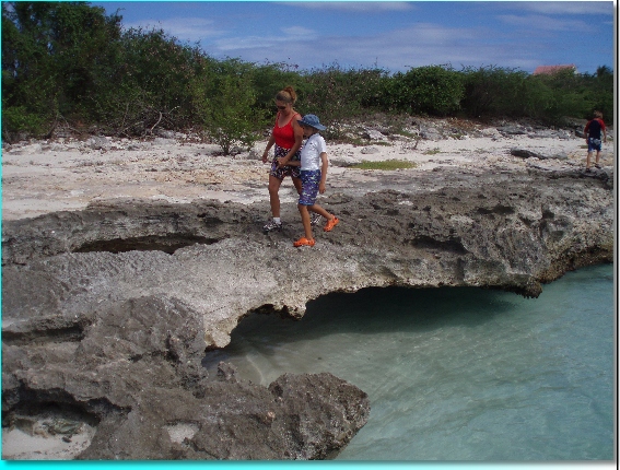
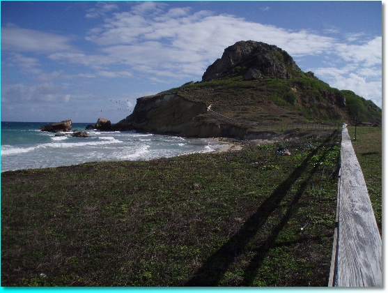
Hoping that the southern coast of Puerto Rico, a favored alternative to the northern coast according to cruisers and guide books alike, might produce something more pleasing than power plants, we left the next morning for a rolly downwind romp to Isla Caja de Muertos, or ‘Coffin Island’. Again, another spot that is a marketeer’s nightmare, Coffin Island ended up being an excellent overnight experience, though. The anchorage was well protected on the lee side of the island, and ashore the government of Puerto Rico had built a substantial set of public buildings for picnicking and recreation, and several trails led around the island including to an old lighthouse building. At the beach, we found what looked like layers of pitted limestone under which the sand had been washed away by the waves. It left limestone ledges, one of which formed a natural bridge that provided much entertainment to the kids.
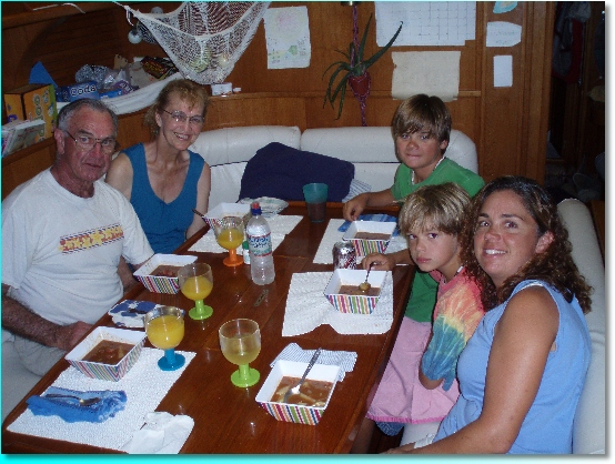
We topped off the evening with a stew, not just any stew, but an infamous concoction called ‘Buck Island Stew’. Many years ago, when my Dad and I were sailing up through North Carolina on the ICW, we anchored off of a Buck Island and used it as the namesake for the stew that we created that night – a simple bachelor-esque affair of polish sausage, cans of pork and beans, carrots, onions and spices. We missed an opportunity to have Buck Island Stew at the Buck Island of St Croix, but the backdrop of Coffin Island provided a suitable alternative for our feast.
From Coffin Island, it is a short few hours of sailing to get into Ponce, the second largest city behind San Juan. We were anxious to get a little culture in us, and Ponce did not disappoint us. The first surprise was the taxi ride into town – by gosh, this town had divided highways and major clover leaf interchanges! At 60 mph, the scenery was moving by far to fast for our sailing state of mind to handle! In the wink of an eye, we were deposited into the center of Ponce, the heart of their restored historic district. Our first task was to locate the tourist information office, which was housed in a restored fire station built in 1883 and bedecked in red and black, Ponce’s colors.
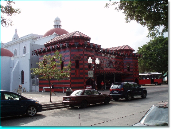
Adjacent to the fire house was the Cathedral of Our Lady of Guadeloupe.
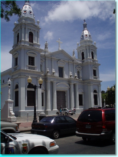
Both the fire house and the cathedral were located in the Plaza Las Delicias, or Plaza of Delights… now there’s a name that is guaranteed to attract visitors! The plaza was quite busy with strollers, particularly uniformed school kids from the Ponce High School. I noticed a gaggle of school girls eyeing us and whispering. What could they be saying about us? Moments later they approached us timidly and their intent became clear – they wanted to try out their English on us! What fun – and a great example for Zachary to witness!
We boarded a well organized city-run trolley tour of the rest of the city, including stops at a supposedly thousand year old Ceiba tree, and the Ponce Museum of Art.
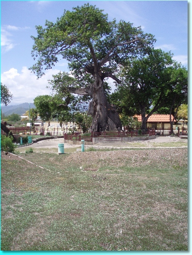
Touring an art museum is not what most people read about in Caribbean travel magazines or long for on cold New England nights, but this museum was very impressive. The building itself was designed by a student of Frank Lloyd Wright, and inside there was an extensive collection of European paintings and sculptors, as well as a growing collection of local art.
That evening, we readied ourselves for a two day excursion by land into San Juan… our first night away from the boat in almost 4 months! Stay tuned for our next installment…
